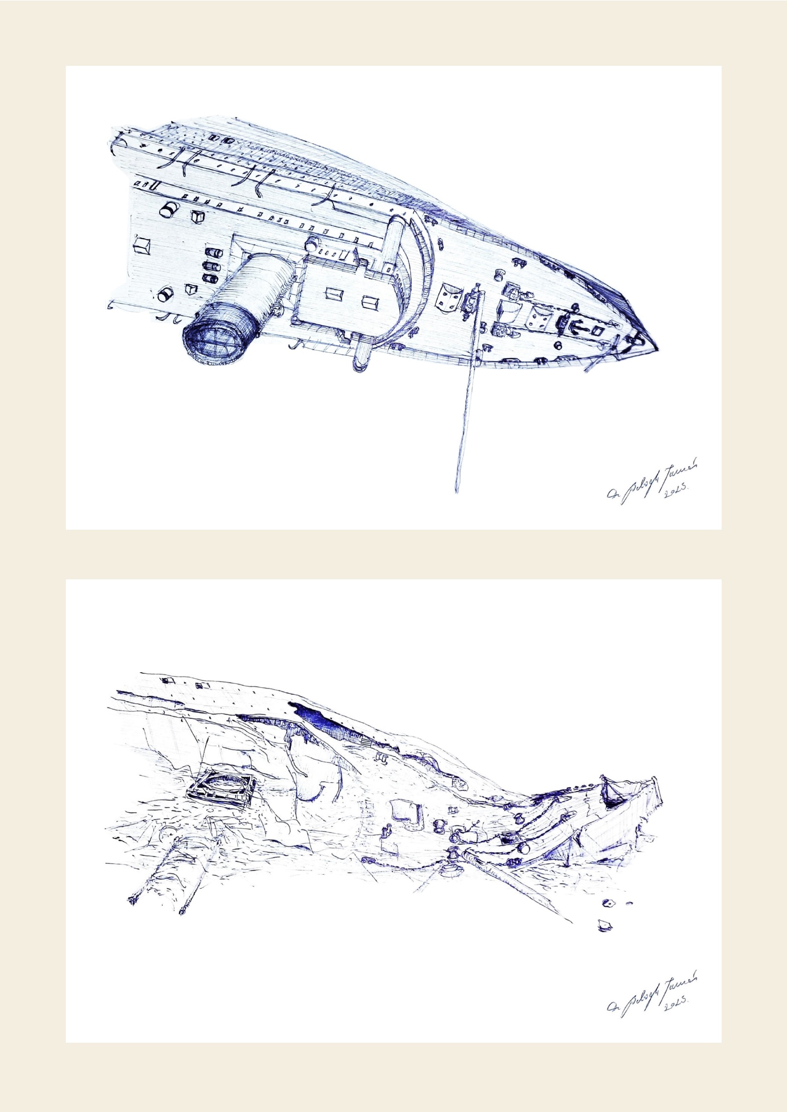
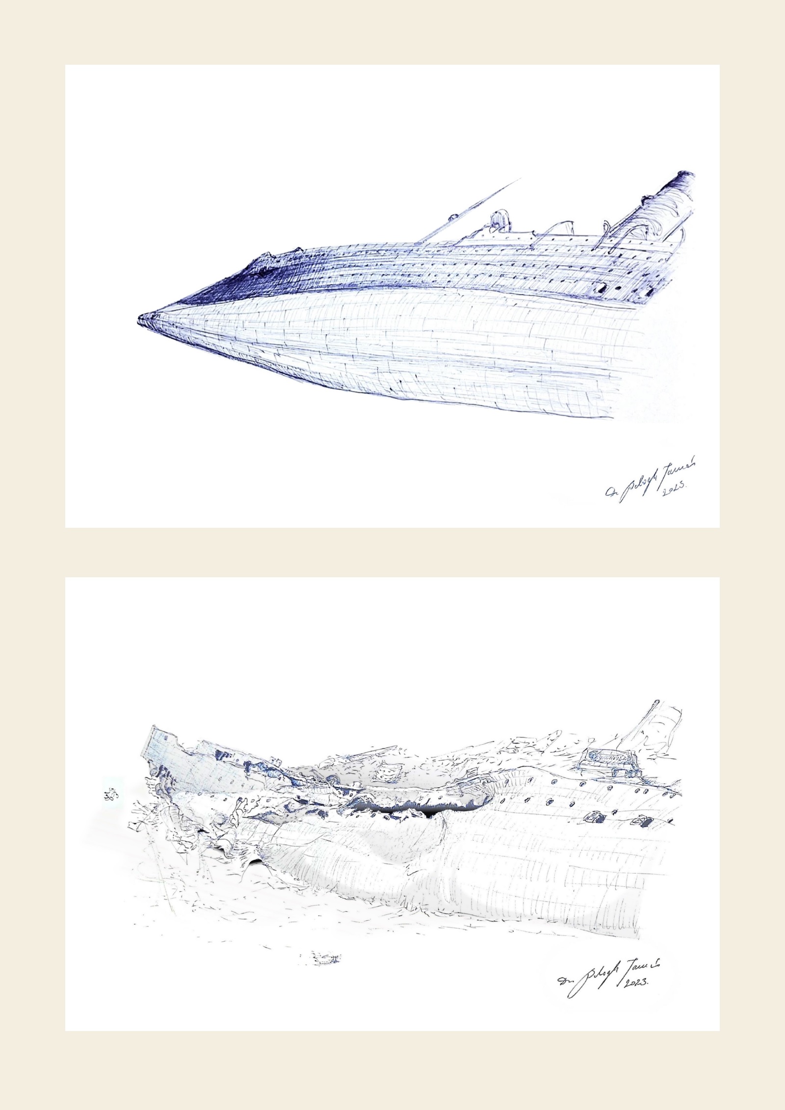
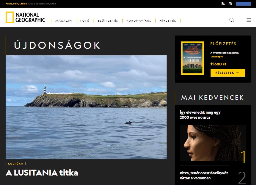
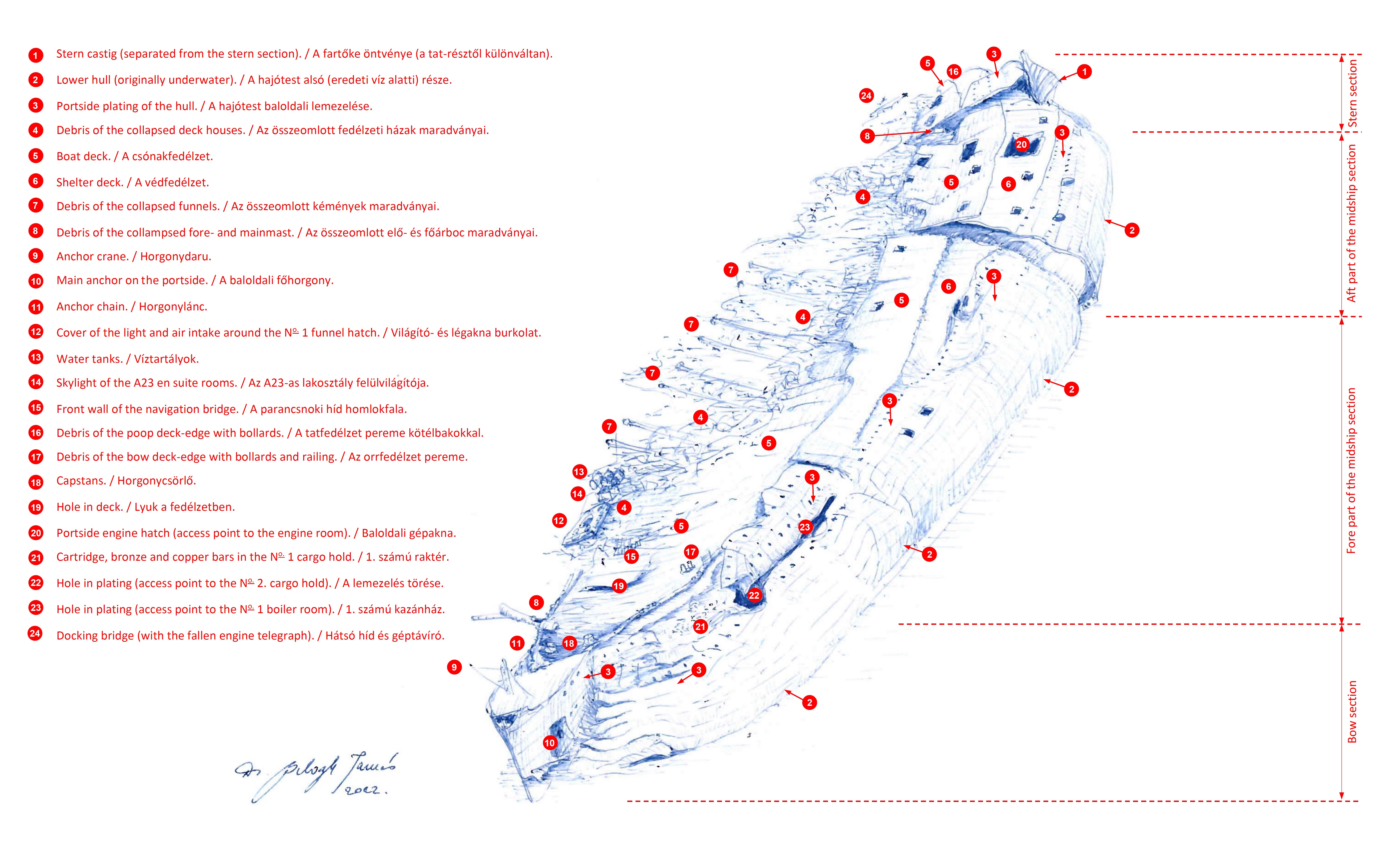
The president of our association, the scientific vice-president of the Hungarian Diving Federation, Dr. Tamás Balogh, and his fellow researcher, Péter Könczöl, were able to join the expeditions in the Atlantic Ocean examining the remains of the sunken oceanliner LUSITANIA in 2022 and 2023. The researchers reported in detail on the results of the historical and on-site research on the website of the National Geographic Hungary magazine (more info about it here). The research, which has been ongoing since then, will be assisted by a new tool from 2025, the wreck map prepared by Dr. Tamás Balogh, summarizing the results of the 2022/23 research, and his earlier works for the visualization of the wrecks have been permanently exhibited at the Lusitania Museum in Kinsale.
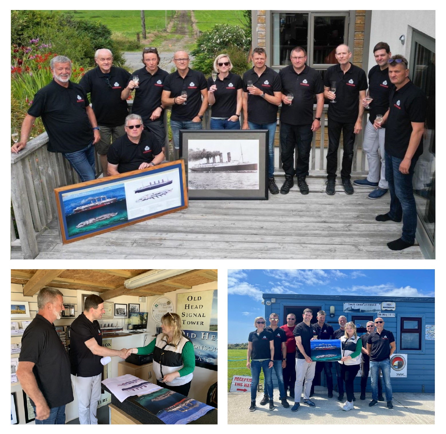
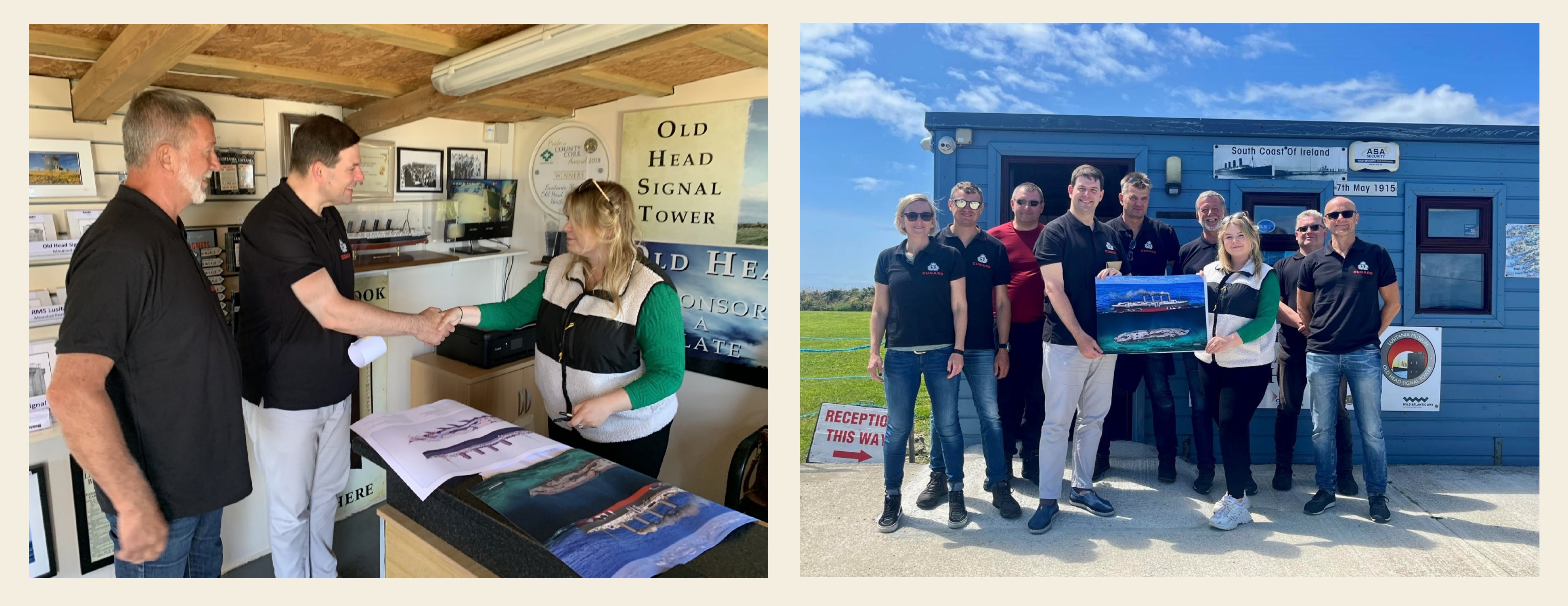
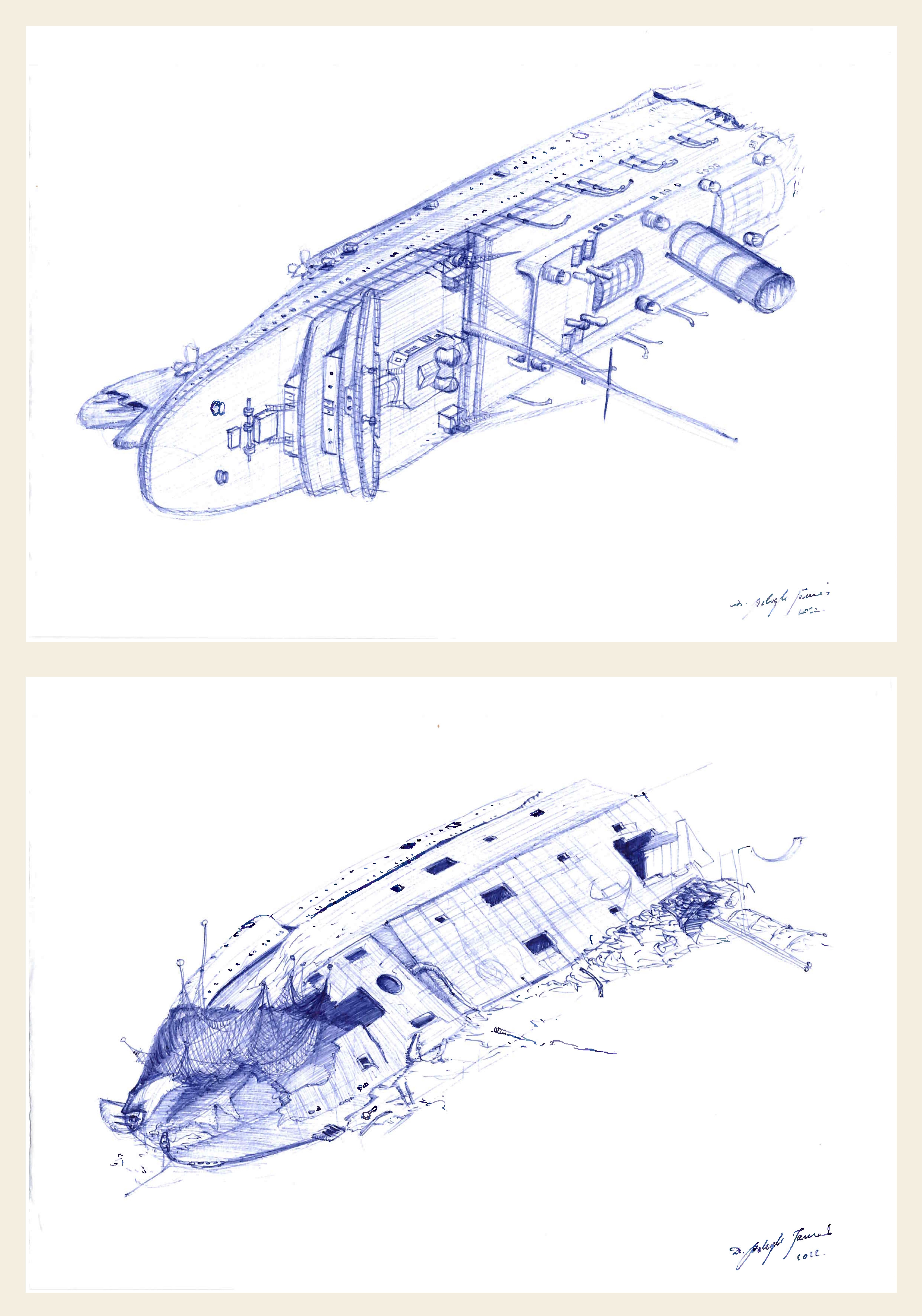
Fig. 1: Dr. Tamás Balogh's drawings (above) and their handover to the museum (below).
Based on the results of the 2022 expedition, Dr. Tamás Balogh created images for visualisation of the wreck site and the original ship, which he donated in 2023 to the LUSITANIA Museum and Old Head Signal Tower in Kinsale, owner of the shipwreck, who permits the expeditions jointly with the Irish state, and has since arranged for presentation of them in the exhibition space.
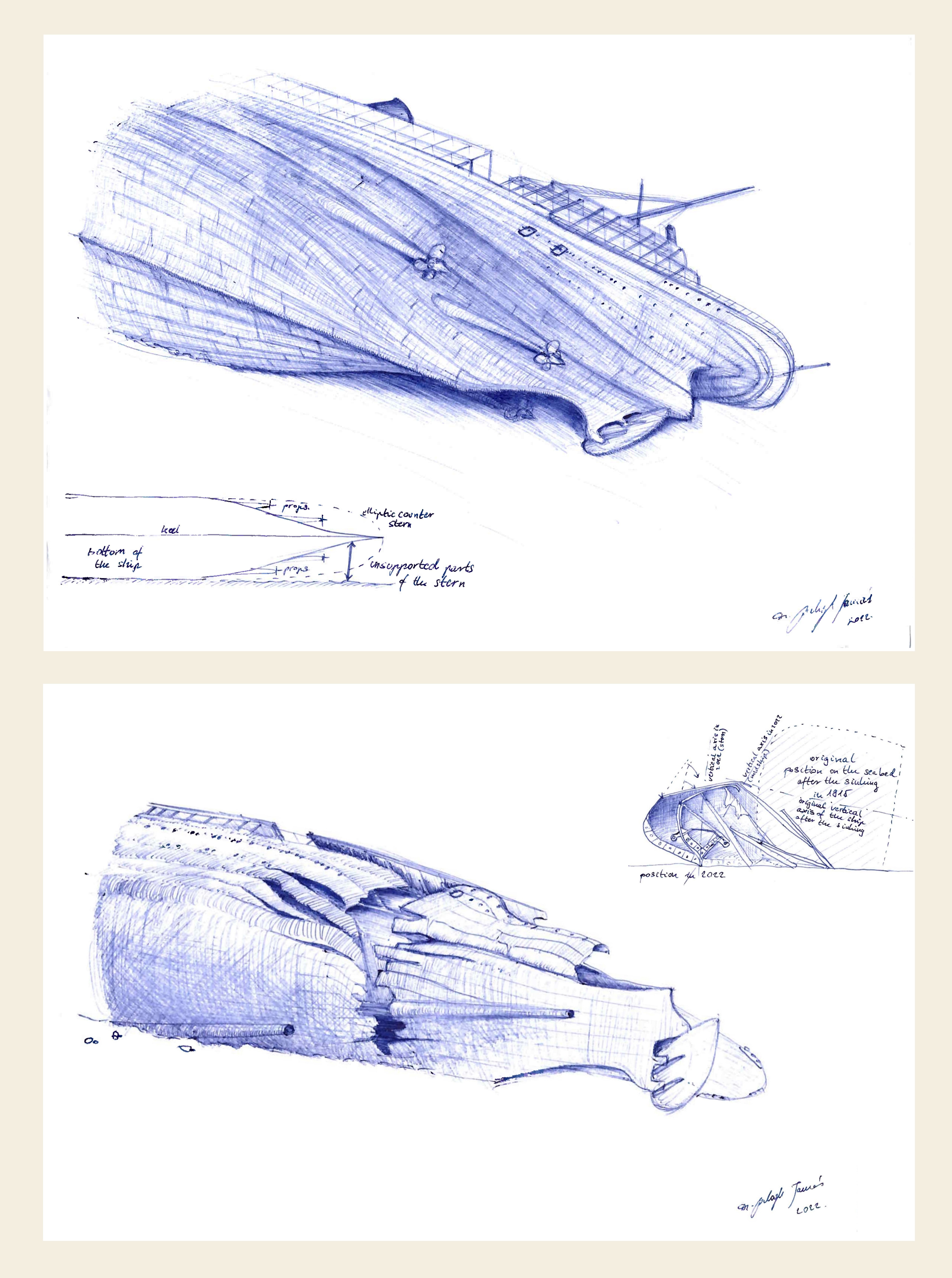
The photographs proving this – presented in the exhibition space together with the donation deed – were taken and sent to the artist by Patrick Valkenborghs, one of the participants in the research that will continue in 2025. Dr. Tamás Balogh created a complete map of the wrecks for the first time in the history of research on the wrecks since 1935, which can be seen here for the first time by those who are interested.
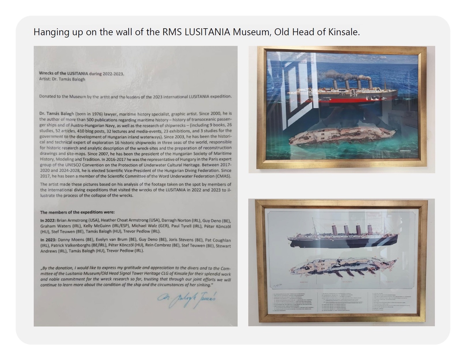
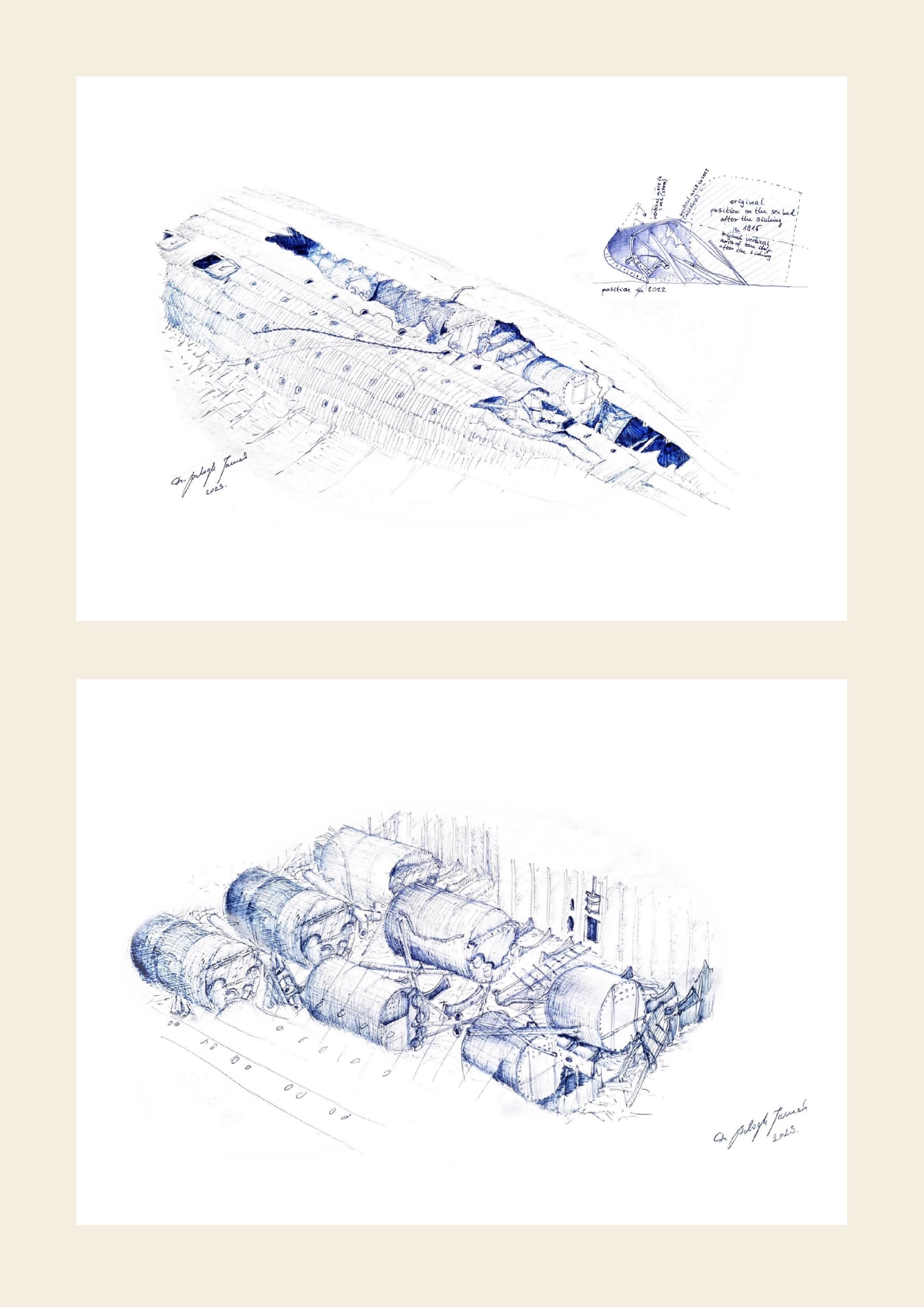
Fig. 2: Dr. Tamás Balogh’s drawings in the museum and the text of the donation deed (in Hungarian: here).
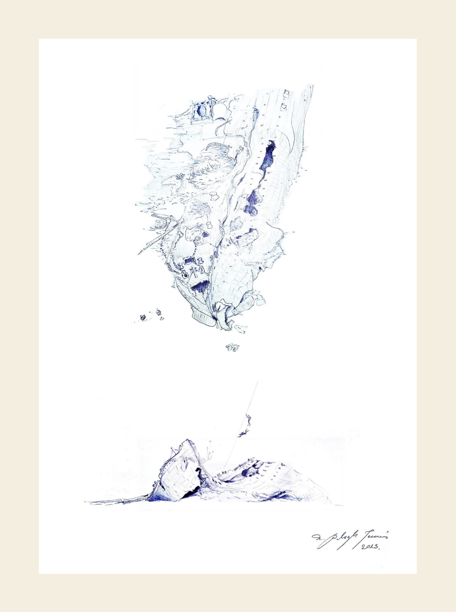
The special feature of the map is that it adapts the excavation grid used in terrestrial archaeology, stretched over the site, to the top view drawing of the wrecks based on the latest research, so that within each 5x5 meter square of the grid made with a 5 meter raster, the exact location of all objects identified on the wrecksite can be marked with an accuracy of 1 meter. The map thus not only identifies the exact location of the objects identified during the work carried out with the participation of Hungarian researchers in 2022 and 2023, but can also be used to plan the remaining research, which is especially important given that its owners would like to add new exhibition spaces to the museum and bring new finds to the surface from the sea for conservation and display.
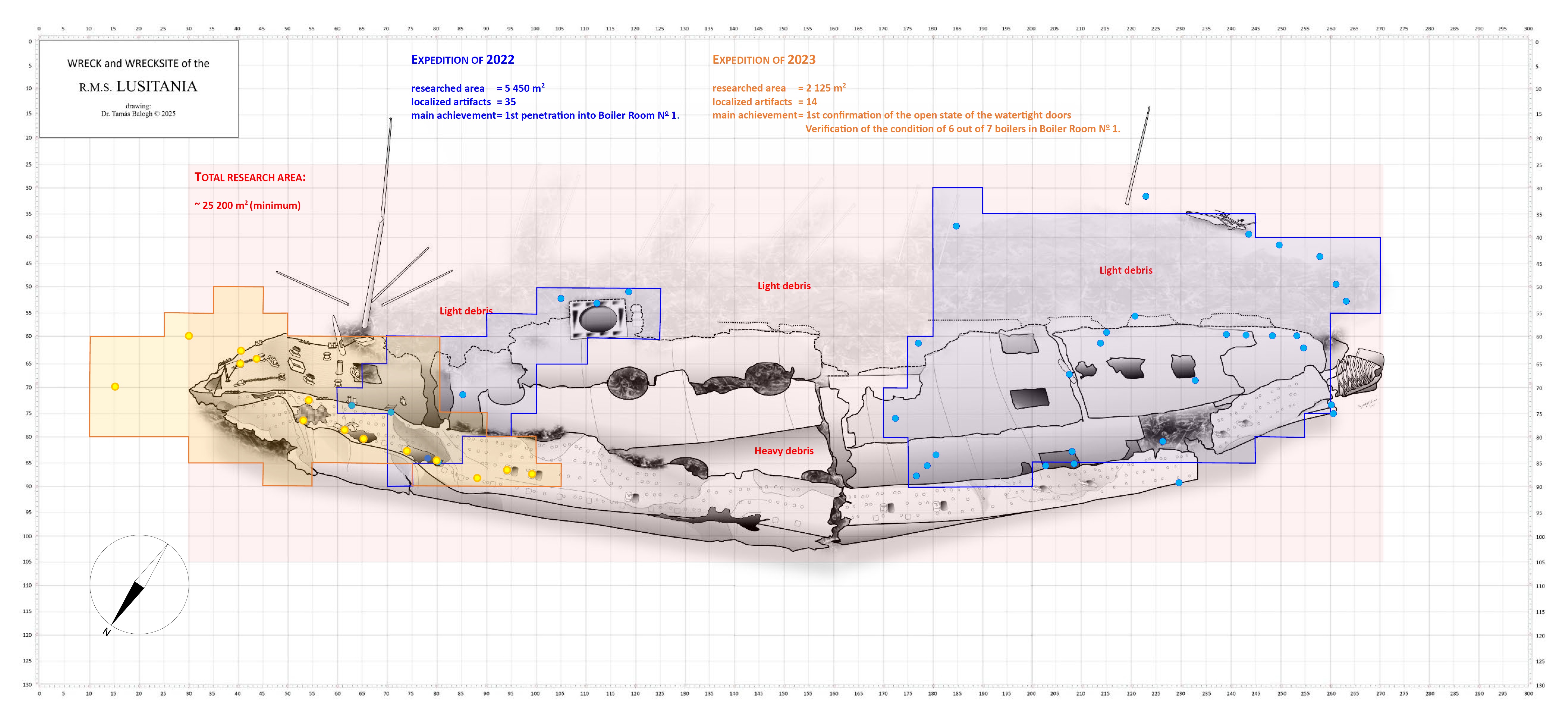
Fig. 3: Dr. Wreck map prepared by Tamás Balogh with the areas explored in 2022 and 2023 and localized finds.
It is a great pleasure and honor that Hungarian experts were able to provide assistance with the work done and the preparation of the map.
It would be great if you like the article and pictures shared. If you are interested in the works of the author, you can find more information about the author and his work on the Encyclopedia of Ocean Liners Fb-page.
If you would like to share the pictures, please do so by always mentioning the artist's name in a credit in your posts. Thank You!
![]()

Utolsó kommentek