On May 1, 2021, Gerard Dooly, a researcher at the University of Limerick in Ireland and a fellow at the University's Mobile and Marine Robotics Research Center, initiated a live broadcast in order to present those underwater survey/visualization infrastructure, which is currently in use for the exploration of the remains of H.M.T. JUSTICIA and H.M.S. AUDACIOUS (largest World War I shipwrecks off the north coast of Ireland) on the North Atlantic. In that broadcast participated a technical diver, diving instructor and wreck photographer, Barry McGill, owner of Indepth Technical Diving, and Tamás Balogh, the president of our association.

Figure 1: Participants in the conversation, Tamás Balogh (left) and Barry McGill (right), while analyzing footage taken during a dive at the wrecksite of JUSTICIA (ex-STATENDAM). The full conversation can be downloaded here.
In 2005, the Geological Survey Ireland and the Marine Institute set up the Integrated Mapping Program for the Sustainable Development of Ireland's Marine Resources (INFOMAR) as a follow-up to the Irish National Seabed Survey (INSS) focusing on the development of products for the integrated imaging of the physical, chemical and biological characteristics of the coastal seabed. The total map coverage of the INSS by the end of 2005 was 432,000 km2, which is 81% of the seabed area of Irish territorial waters. INFOMAR is the largest seabed survey program currently underway in the world. Not only in terms of its geographical scope, but also in terms of its dynamizing impact on a wide range of science, the economy and society. The program helps to understand the seabed's fauna, ecosystem, economic treasures, structural morphology, as well as the development of mapping and visualization applications and robotics (unmanned underwater vehicles), as well as the relationship between research and business in the field of newly developed solutions for production. and industrial application). One important partner in the implementation of the INFOMAR program is the University of Limerick, whose Mobile and Marine Robotics Research Center (MMRRC) is developing the infrastructure for the mapping program.
One of the important beneficial side effects of a large-scale integrated marine resource assessment program is the collection of position and depth data essential for shipwreck mapping and the production of three-dimensional seabed and wreck maps produced with high-efficiency sonar equipment. As a result, we now know exact datas of 270 shipwrecks out of some 15,000, in the waters around Ireland, mostly from the First and Second World Wars. Of these, 90 are located in the vicinity of the Malin Head, and 46 of them are also known by name. One of these 46 shipwrecks is the H.M.T. JUSTICIA (ex-s.s. STATENDAM) ocean liner and H.M.S. AUDACIOUS dreadnought-type battleship, the remains of which lie near the northernmost point of the island of Ireland, the Malin Head, at a depth of 68 m.
Barry McGill has long been a regular participant in the research of historic shipwrecks near the Malin Head, and together with Tamás Balogh they participated in a 2019 expedition researching the wreck of H.M.T. JUSTICIA. The two researchers commented on the images transmitted from the site during check-in by a research team led by Ger Dooly, while the expedition is currently examined the wreck of the H.M.S. AUDACIOUS (H.M.T. JUSTICIA was examined on the previous day).
H.M.S. AUDACIOUS was one of the newest (1912 built) dreadnought type British battleships (like the Austro-Hungarian SZENT ISTVÁN). On the morning of 27 October 1914, barely three months after the outbreak of World War I, she ran onto a sea mine, layed by the german minelaying ship S.S. BERLIN (converted passenger liner) off the north coast of Ireland . The sea-mine exploded on the left side of the battleship, under one of the engine rooms (unfortunately, just 3 feet in front of the engine room’s rear watertight bulkhead), so only the center and right engine rooms continued to function. The ship tilt increased until 15 degrees (which was decreased to 9 degrees by counter-flooding) continued her way at reduced speed and ask for towing. Then, with the exception of the battleships, all vessels in the vicinity were ordered to rescue (due to the importance of AUDACIOUS, not caring that rescue-ships could also hit mines). The huge R.M.S., OLYMPIC, TITANIC’s sister ship was also nearby, on her way, full of passengers, also hurried to the scene, and since the battleship was still deemed rescuable, sent a tow rope over, trying to tow the H.M.S. AUDACIOUS to the nearest port. However the damaged battleship gradually became more and more flooded by the heavily waveing sea, and - when she eventually became unnavigable - her commander gave the order to abandon her. Most of the crew is picked up by the OLYMPIC. The H.M.S. AUDACIOUS was finally sunk at night, 12 hours after the mine exploded. The only victim of the incident was a petty officer of the cruiser H.M.S. LIVERPOOL, who was hit by a metal piece when the H.M.S. AUDACIOUS capsised and exploded shortly before its final plunge (as the shells - stored in the magazine of the forward gun turret - detonated and the cordite ignited by this).
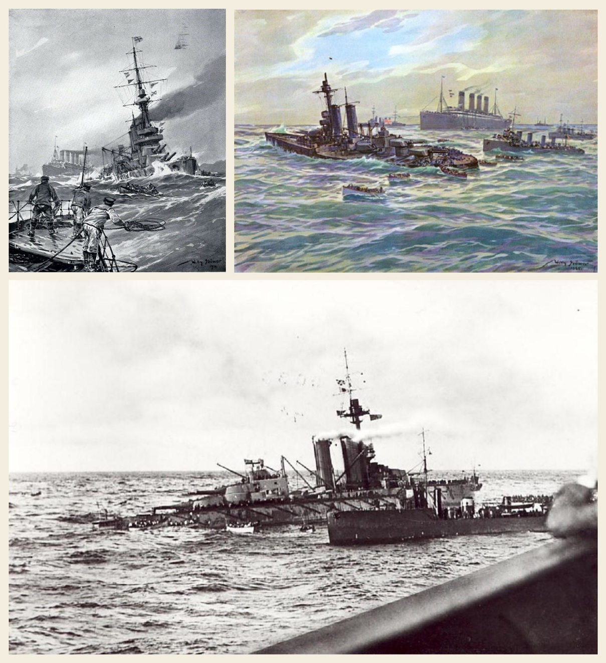
Figure 2: Contemporary painting of the H.M.S. AUDACIOUS and R.M.S. OLYMPIC made by famous German naval painter Willy Stöwer and a photograph taken by an American passenger aboard the ocean liner (in the foreground of the latter picture is the bulwark of the boatdeck, while lifeboats of the OLYMPIC can be seen at the stern of the damaged battleship).
The bow broken off due to the ammunition explosion is further away from the rest of the hull. Between the two parts of the hull lies the forward gun turret, which has fallen out of its original position, and the armored barbetta separated from it. The capsized hull is in the final stage of collapse, as the unarmoured parts of the hull gradually falls between the armored - and therefore extremely solid - side walls of the hull (the same process is just going on for similar reasons in case of the sunken Austro-Hungarian battleship SZENT ISTVÁN which is only 2 years younger than H.M.S. AUDACIOUS). Therefore, the accurate recording of the wreck and of the correlation between the parts of it, is a particularly important task, as with the final collapse, a significant part of the ship's explorable past will also be lost. With technology developed by Ger Dooly and his team, the capsized and disintegrated wreck was therefore virtually scanned. As it is a ship 182 m long and 27 m wide, this is no small task. Nevertheless, a remotely operated vehicle (ROV) wich can keep a constant depth under water and a constant distance from the wreck with the laser beam emitted by the attached detector, traveled through the wrecksite just like a 3D scanner on an object selected for digital fixing. The process thus provides a much more complete picture of the wreck and the wrecksite as a whole than what traditional diving expeditions would be able to do in the same amount of time. This technique therefore provides a more complete and detailed picture of the wreck than ever before, greatly aiding the research of them and reducing the risk of work, as the high-detail picture can be taken without even a single diver having to dive to the seafloor. This procedure is the most advanced and efficient way currently available to visually display wrecks.
The mapping of wrecks, the recording and display of data from on-site surveys has undergone long development. The first open-circuit scuba technology was designed by Jacques Yves Cousteau in 1942, and the first underwater camera was not constructed until 1963 (invented by Jean de Wouters). Until now, archaeologists involved in the work of divers have only been able to record the location and condition of a site and the finds found there, only by making drawings and reconstructive representations used in land archaeological excavations, ie by observation with the naked eye. The first major change was the underwater magnometer developed in 1953, the side-scan sonar published in 1954, and the sub-bottom profiler that has been prevalent since the 1960s. The magnetometer made it possible to separate metal and wood (so it could only be used for already known sites), and the sonar and sub-bottom profiler based on signal reflection drew the topography of the seafloor (making it easier to navigate) and helped identification of subsurface or other structures which burried with sediment. With the further development of the first underwater stereo cameras - developed between 1966-71 - the method of photogrammetry has been applied since 1991, which builds a three-dimensional image from two-dimensional photographs. Thanks to the development of 3D printing, this image itself can even be printed as well. All this helps research and museum pedagogy alike, as the finds become tangible to researchers and those interested.
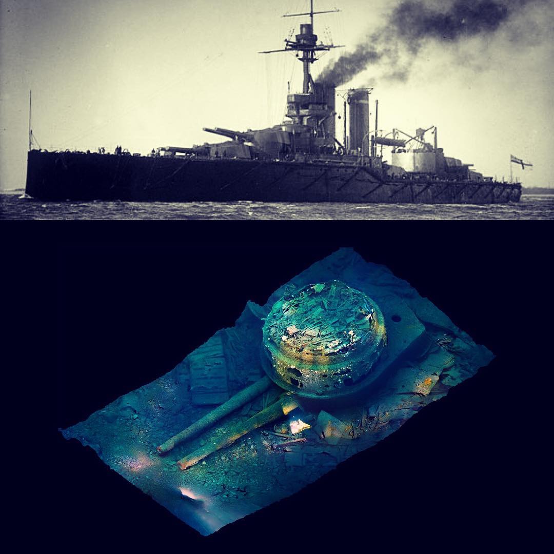
Figure 3: During the exploration of sunken remains of the TITANIC, perhaps the most famous shipwreck in the world, researchers helped in their orientation and analytical work by a huge photographic mosaics composed of many thousands photographs. However, by the advance in technology, these static, two-dimensional images have acquired a rotatable, spatial representation. You can see above the photogrammetric 3D image of the forward gun-turret of H.M.S. AUDACIOUS torn from the overturned hull (Matt Carter, Barry McGill, 2017). The rotatable 3D model is available here.
The latest generation of tools to support shipwreck research is the underwater scanners used by Ger and his team and augmented reality (the current state is complemented by virtual reality), which is capable of spectacularly visualizing changes (especially attracting young interested age groups). The connected geoinformation system - GIS - combines and transforms the data extracted through all these tools and procedures into a database, which (even in the current live broadcast) can be freely forwarded, so it is one of the most effective tool for information sharing, which is one of the most important goal of the archeology in addition to information acquisition (survey and documentation).
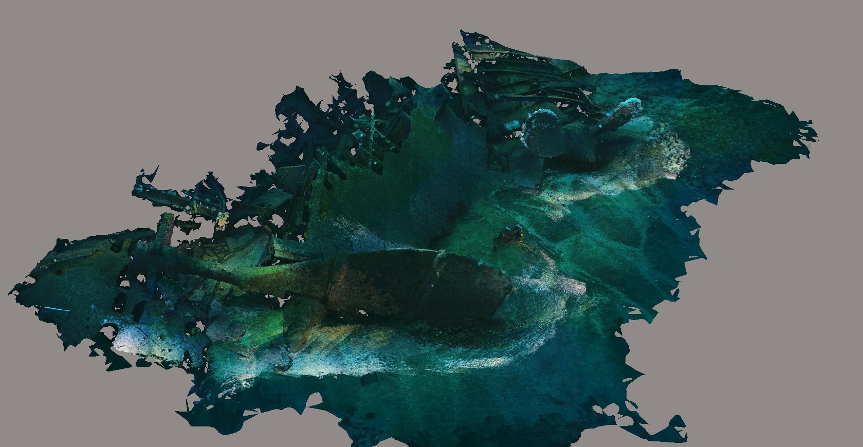
Figure 4: Results of a photogrammetric survey of the stern section of the JUSTICIA's (ex-STATENDAM's) wreck according to the progress made in July 2020. In the foreground of the picture is the rudder blade attached to the left-tilted stern post, and to the right in front of that (closer to the upper edge of the picture) are the two blades of the right propeller which is partially buried by the sediment. (Source University of Limerick, Ger Dooly, Indepth Technical Diving, SANTI diving TEAM, SANTI Diving, Big Blue Dive Lights).
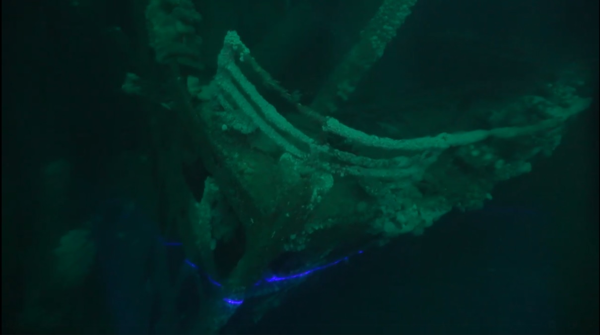
Figure 5: The underwater laser scanner in work, the at the tip of the bow of the JUSTICIA's wreck. Source.
During the conversation that accompanied the spectacular presentation, Barry McGill reported details of a series of research on the wreckage of H.M.S. AUDACIOUS, demonstrating how the strong current that can be felt everywhere in the shallow sea makes it difficult for divers, who can be swept away from their desired position on the one hand, and blinded them on the other hand by the sediment and by the fine-grained rust (which rises in clouds from the wreck during the sudden collapse of a larger structural element), kept in motion by the current, minimizing the visibility. At the same time, Barry did not fail to mention that the wildlife of the continental shelf is also present on the wreckage and sometimes a seal appears among the remains.
Tamás Balogh emphasized the importance of H.M.T. JUSTICIA (ex-STATENDAM), in this context, addressing in particular why the ship is often referred to as the “Dutch TITANIC”. With the scheduled construction of the sister ships OLYMPIC, TITANIC and GIGANTIC, the Harland & Wolff Shipyard in Belfast is prepared to mass-produce the highest quality ocean liners for any nation in the world. Thus, when the Dutch also ordered the type, the shipyard made - on the basis of TITANIC's plans - a slightly smaller vessel (which was the first ship constructed after the TITANIC's launch), optimized for shallower Dutch waters. In addition, the ship was the largest shipwreck sunk by torpedoes in World War I, and the infamous wolf pack tactics of the German submarines of World War II, were created during the sinking of this ship. However, the fierce German attempts to sink the ship at all costs was the result of a misidentification, when Otto von Schrader, the commander of the first German attacker, U-64, confused her with the similar German ocean liner VATERLAND (which remained in the neutral USA at the outbreak of the war, but by 1918, however, she had already transported American soldiers across the ocean against Germany, so the submarines of the German Navy competed with each other to try to sink her as soon as possible).
At the end of the conversation, Ger Dooly emphasized that they wanted to make it possible to apply this spectacularly advanced technology widely, thanks to the partnership of the university. (We note that this technology - with proper foresight and some luck - can even be used in the research of historical shipwrecks important to Hungary, such as the battleship SZENT ISTVÁN, which is a contemporary of H.M.S. AUDACIOUS). The interlocutors then thanked for the spectacular presentation. Barry expressed the hope that the survey, which had begun at the two major sites, could be continued out together as soon as possible and, if possible, that the technology could be used in the exploration of another historic wreck, the LUSITANIA, near to the south coast of Ireland. Tamás Balogh pointed out that a thorough photogrammetric and laser survey covering every detail is probably the most modern technology to implement Dr. Robert Ballard's idea from the 1990s, the virtual deep sea museum.
In any case, with the help of the presented infrastructure, anybody can take a virtual tour at any shipwreck and wreck site, and the image of shipwrecks can be maintained forever. Without having to move anything out of place, or without having to worry about the original material, which - in its previously known form - gradually disappearing during the years. In this way, this technology not only preserve the cultural heritage, but it also makes it much more spectacular than any previous visualization options, making the context easier to understand for those who are less experienced in wreckdiving. Just like the 3D reconstructive animations which shows the original appearance of the ships, of which the latest work represents the H.M.T. JUSTICIA (ex-STATENDAM) which was presented as a farewell to those who are interested in.

Figure 6: Some movie frames from the animation showing STATENDAM (Source: Dr. Tamás Balogh).
It would be great if you like the article and pictures shared. If you are interested in the works of the author, you can find more information about the author and his work on the Encyclopedia of Ocean Liners Fb-page.
If you would like to share the pictures, please do so by always mentioning the artist's name in a credit in your posts. Thank You!
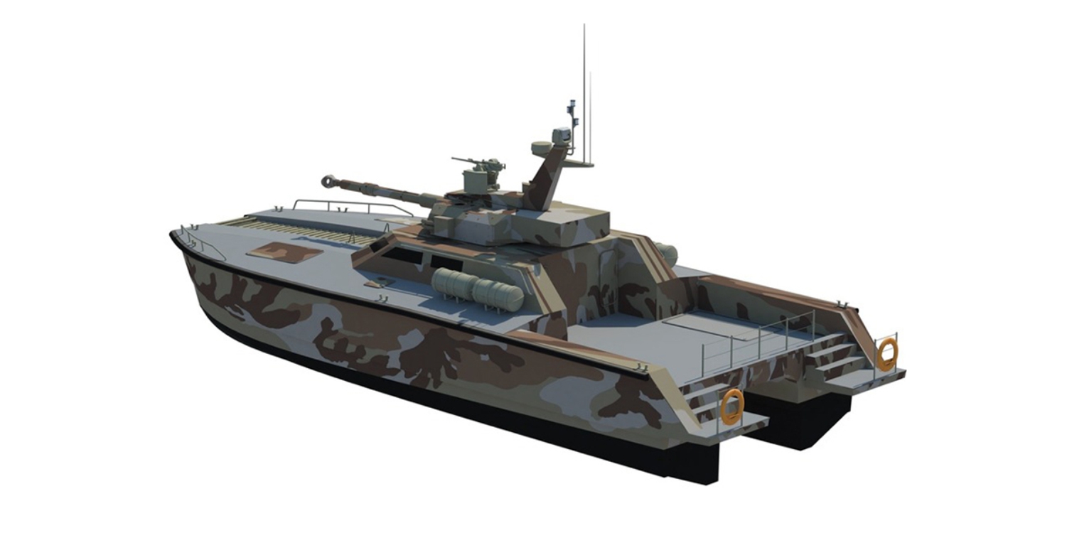 1. ábra: A PT Lundin X-18 "úszó tank" látványterve (Forrás:
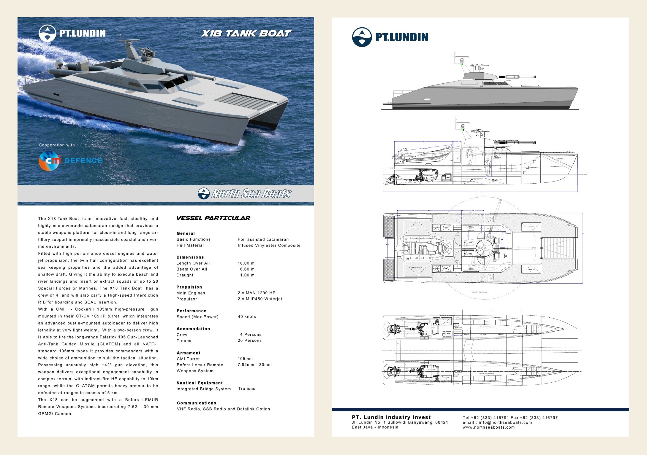
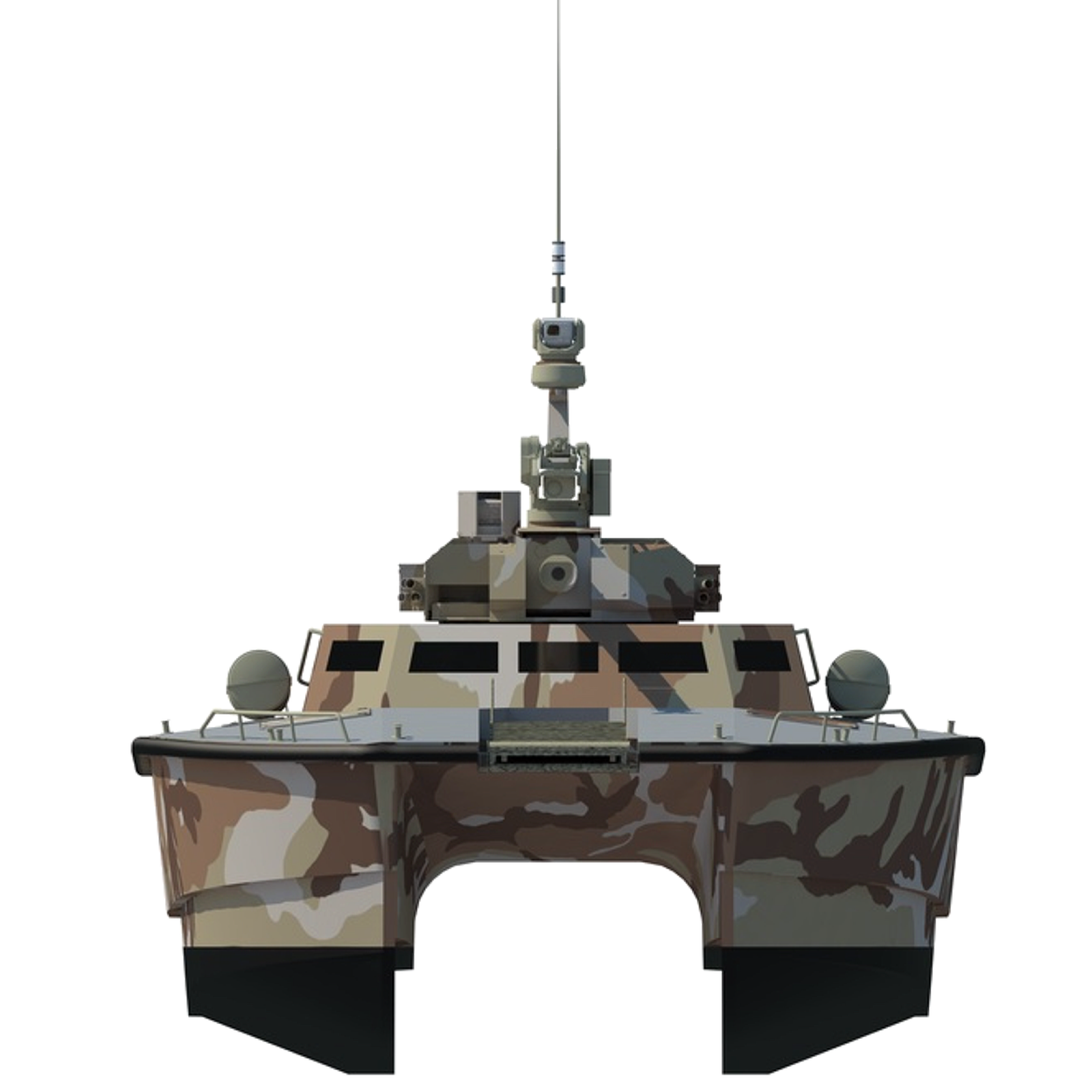 4. ábra: A PT Lundin X-18 "úszó tank" látványterve (Forrás:


Utolsó kommentek